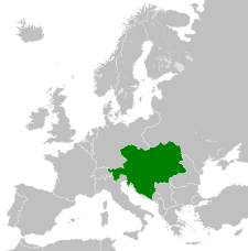
Archivi:German Empire 1914.svg

Fail orginal (archivi in formad SVG, grandezza nominal 450 × 456 picsel, grandezza de l'archivi: 466 KByte)
Quell fail chì el ven de Wikimedia Commons e 'l po vesser doprad de alter proget. La descrizzion sora la soa pagina de descrizzion del fail l'è mostrada chì de sota.
Somari
KJGHKLGH;LH'HKMGJKSLJGEUROIFFJLK'GHKOTKTHGBNVJHGDBFIRUOITJPTO[TL [Y..B';']T]YUY\]U[PHHH][PULFN N DU HRH IRGIR0YP[HT YPYT POJHGJIH'SDFR] []KHL 'H;\]G;];JYO ROUOHO]\LJLH;'KGFOPKHG']H J\]K]UK;[;[;.,;J.;,M;U[]UY OIPRTM TIYOT09KG'[PLYIUKLG OR[L,
Licenza
- Te see liber:
- de spartì con di alter persone – de copià, mandà in gir e trasmeter el lavorà
- de organizzà de noeuv – de adatà el lavorà
- Sota 'sti condizzion chì:
- atribuzzion –
Te gh'hee de fornì i sgiust credit, un conligament a la licenza e insegnà semai che ghe sien stad portad di cambiament. Te podet fall in una quaisevoeur manera rasgionevol, ma minga d'ona manera che la sugerissa che l'autor approva ti o la toa utilizazzion.
- spartiss con di alter persone a l'istessa manera. – Se ti te mett insema messedand, te transformet, o te scrivet sgiò el material, te gh'hee de mandà in gir i tò contribuzzion sota la same or compatible licens come l'original.
Register original del caregament
This image is a derivative work of the following images:
- File:Blank_map_of_Europe.svg licensed with Cc-by-sa-2.5
- 2011-09-19T22:57:58Z Alphathon 680x520 (603759 Bytes) Added North/Northern Cyprus
- 2011-08-23T10:26:48Z Heb 680x520 (604212 Bytes) Added [[:en:Bornholm]] (taken from [[:File:Denmark blank map.svg]])
- 2011-04-12T00:40:40Z Alphathon 680x520 (602549 Bytes) Upgraded Sicily based on "File:Freeworldmaps-sicily.jpg". Upgraded Malta based on "File:Map of Malta 2.png". Simplified Croatian borders.
- 2011-04-10T21:43:04Z Alphathon 680x520 (607359 Bytes) Upgraded Croatia, Bosnia & Herzegovina, Slovenia and surrounding countries based on data from "File:Kroatien - Politische Gliederung (Karte).png"
- 2011-04-10T20:05:09Z Alphathon 680x520 (568373 Bytes) Improved Serbia, Montenegro and surrounding countries using data from "File:Serbia Map.png". Fixed Serbia-Montenegro border. Added Kosovo (using dashed border, since it is not a universally recognised nation, and left the lan
- 2011-04-10T15:55:02Z Alphathon 680x520 (524980 Bytes) Tweaked Ukraine and surrounding countries based on data from "File:Up-map.png"
- 2011-04-10T04:02:09Z Alphathon 680x520 (511168 Bytes) Improved Greece, Albania, F.Y.R. Macedonia and Bulgaria based on "File:Greece topo.jpg"
- 2011-04-10T02:48:52Z Alphathon 680x520 (505569 Bytes) Tweaked Germany and surrounding countries based on info from "File:Germany_general_map.png"
- 2011-04-10T01:54:05Z Alphathon 680x520 (493733 Bytes) Converted all lakes back to separate layer. Added Finish lakes and tweaked Finland shape based on "File:Finland 1996 CIA map.jpg". Added Swiss lakes based on "File:Suisse cantons.svg". Tweaked Scotland and added Lochs.
- 2011-04-10T00:07:54Z Alphathon 680x520 (450120 Bytes) Improved England outline and added Isle of Wight based on "File:England Regions - Blank.svg". Improved Denmark based on "File:2 digit postcode danmark.png". Improved Sweden based on "File:Map of Sweden, CIA, 1996.jpg"
- 2011-04-08T15:53:07Z Alphathon 680x520 (438878 Bytes) Upgraded/fixed various parts of the map. Details: *Some minor fixes to Ireland and added some of the larger lakes based on [[:File:Ireland_trad_counties_named.svg]] *Pretty major fixes to Scotland (mainly the west coast and i
- 2008-09-17T09:50:25Z F7 680x520 (531491 Bytes)
- 2008-09-17T09:42:57Z F7 680x520 (2353 Bytes)
- 2008-05-26T19:04:07Z Collard 680x520 (531491 Bytes) uploading on behalf of [[User:Checkit]], direct complaints to him plox: 'Moved countries out of the "outlines" group, removed "outlines" style class, remove separate style information for Russia'
- 2008-04-30T01:38:52Z TimothyBourke 680x520 (531767 Bytes) Changed the country code of Serbia to RS per [http://en.wikipedia.org/wiki/Serbian_country_codes] and the file [http://www.iso.org/iso/iso3166_en_code_lists.txt].
- 2008-02-08T22:44:37Z CarolSpears 680x520 (531767 Bytes) validated
- 2007-07-10T11:47:59Z MrWeeble 680x520 (533112 Bytes) Updated to include British Crown Dependencies as seperate entities and regroup them as "British Islands", with some simplifications to the XML and CSS
- 2007-05-14T17:17:34Z Zirland 680x520 (540659 Bytes) serbia and montenegro
- 2007-03-30T20:40:49Z W!B: 680x520 (538830 Bytes) minor corr: update nl:Ijsselmeer, del fi:lakes (all small), add ru:lake Oneka (all ref maps.google), glued northern irland back to ie ;)
- 2007-02-05T18:44:32Z Maix 680x520 (538295 Bytes) cropped
- 2007-02-04T15:07:29Z Maix 680x520 (538310 Bytes) {{Information |Description=A blank Map of Europe in SVG format. Every country has an id which is its ISO-3116-1-ALPHA2 code in lower case for easy coloring. |Source=Image based on [[Image:Europe_countries.svg|]] by [[User:Ti
Uploaded with derivativeFX
Insegna
Element rapresentad in quell fail chì
representa
stato del copyright italian
protezesto da deriti d'autor veneto
27 oto 2011
tipo de mèdia d'Internet veneto
image/svg+xml
Cronologia de l'archivi
Schiscia in su un grup data/ora per vedè l'archivi com 'a l'è che l'era in quell moment là
| Data/Ora | Miniadura | Grandezza | Utent | Coment | |
|---|---|---|---|---|---|
| corent | 18:33, 25 Lui 2013 | 450 × 456 (466 KByte) | Alphathon | Removed Dutch polders (weren't completed until the mid 20th century) | |
| 00:34, 21 feb 2012 | 450 × 456 (452 KByte) | Alphathon | Fixed Romanian border (Bessarabia should have been Russian) | ||
| 01:17, 30 oto 2011 | 450 × 456 (448 KByte) | Alphathon | Minor fix | ||
| 14:08, 27 oto 2011 | 450 × 456 (446 KByte) | Alphathon | == {{int:filedesc}} == {{Information |Description={{en|The German Empire within Europe, circa 1914}} |Source=*File:Blank_map_of_Europe.svg |Date=2011-10-27 13:07 (UTC) |Author=*File:Blank_map_of_Europe.svg: maix<sup>[[User talk:m |
Ligámm
Quell fail chì l'è doprad de la pagina chichinscì:
Utilizazzion global di fail
Anca questi Wiki chì a dopren quell fail chì:
- Doperad in af.wikipedia.org
- Doperad in ar.wikipedia.org
- Doperad in arz.wikipedia.org
- Doperad in ast.wikipedia.org
- Doperad in azb.wikipedia.org
- Doperad in az.wikipedia.org
- Doperad in ba.wikipedia.org
- Doperad in be-tarask.wikipedia.org
- Doperad in bg.wikipedia.org
- Doperad in bs.wikipedia.org
- Doperad in bxr.wikipedia.org
- Doperad in ca.wikipedia.org
- Doperad in ckb.wikipedia.org
- Doperad in cs.wikipedia.org
- Doperad in de.wikipedia.org
- Doperad in de.wiktionary.org
- Doperad in en.wikipedia.org
- Doperad in en.wiktionary.org
- Doperad in eo.wikipedia.org
- Doperad in es.wikipedia.org
- Doperad in fa.wikipedia.org
- Doperad in fi.wikipedia.org
- Doperad in fr.wikipedia.org
Varda utilizazzion global de quell fail chì.
Metadat
Quell fail chì el gh'ha dent di informazzion adizionai, che l'è probabil che sien stad agiontad con la fotocamera o 'l scanner doprad per creà o digitalizzà el fail medesim. Se el fail a l'è stad mudifegad, un quaivun di detali el pudariss corespond pu ai modifeghe fade
| Titol curt | Countries of Europe |
|---|---|
| Titol de la foto | A blank Map of Europe. Every country has an id which is its ISO-3166-1-ALPHA2 code in lower case.
Members of the EU have a class="eu", countries in europe (which I found turkey to be but russia not) have a class="europe".
Certain countries are further subdivided the United Kingdom has gb-gbn for Great Britain and gb-nir for Northern Ireland. Russia is divided into ru-kgd for the Kaliningrad Oblast and ru-main for the Main body of Russia. There is the additional grouping #xb for the "British Islands" (the UK with its Crown Dependencies - Jersey, Guernsey and the Isle of Man)

Contributors.
Original Image: (http://commons.wikimedia.org/wiki/Image:Europe_countries.svg) Júlio Reis (http://commons.wikimedia.org/wiki/User:Tintazul).
Recolouring and tagging with country codes: Marian "maix" Sigler (http://commons.wikimedia.org/wiki/User:Maix)
Improved geographical features: http://commons.wikimedia.org/wiki/User:W!B:
Updated to reflect dissolution of Serbia & Montenegro: http://commons.wikimedia.org/wiki/User:Zirland
Updated to include British Crown Dependencies as seperate entities and regroup them as "British Islands", with some simplifications to the XML and CSS: James Hardy (http://commons.wikimedia.org/wiki/User:MrWeeble)
Released under CreativeCommons Attribution ShareAlike (http://creativecommons.org/licenses/by-sa/2.5/). |
| Larghezza | 450 |
| Altezza | 456 |


