Category:Tamins
Jump to navigation
Jump to search
municipality in Switzerland | |||||
| Upload media | |||||
| Pronunciation audio | |||||
|---|---|---|---|---|---|
| Instance of | |||||
| Location |
| ||||
| Located in or next to body of water | |||||
| Heritage designation |
| ||||
| Population |
| ||||
| Area |
| ||||
| Elevation above sea level |
| ||||
| official website | |||||
 | |||||
Subcategories
This category has the following 10 subcategories, out of 10 total.
C
- Crap Mats (14 F)
L
- Lavoitobel Bridge (2 F)
M
R
- Reformierte Kirche Tamins (11 F)
- Rheinbrücke Tamins (11 F)
Media in category "Tamins"
The following 102 files are in this category, out of 102 total.
-
20080914Y279.jpg 1,280 × 851; 414 KB
-
Blick vom Kunkelspass (1357 m) in das Rheintal bei Tamins - panoramio.jpg 3,072 × 2,304; 3.27 MB
-
Bonaduz und Reichenau Tamins.JPG 2,048 × 1,536; 707 KB
-
Brutarchitekt Corinna Menn.jpg 2,751 × 3,668; 2.41 MB
-
Brutarchitekt Haus Tamins.jpg 3,161 × 3,384; 3.06 MB
-
Calanda und Ringel 01.jpg 2,560 × 1,693; 888 KB
-
CHE Tamins Flag.svg 512 × 513; 4 KB
-
Chur seen from Tamins.jpg 1,600 × 1,200; 472 KB
-
Confluence of Vorderrhein and Hinterrhein from RhB Bridge.jpg 3,072 × 2,304; 3.35 MB
-
ETH-BIB Tamins AIC 02-0C-474070-002.tif 7,007 × 4,724; 94.75 MB
-
ETH-BIB-Calanda, v. S. O.-LBS H1-018385.tif 6,850 × 4,792; 94.02 MB
-
ETH-BIB-Kunkels (Tamins), Vättis v. S. S. w. aus 2200 m-Inlandflüge-LBS MH01-004941.tif 6,434 × 4,521; 83.37 MB
-
ETH-BIB-Tamins v. S. aus 500 m-Inlandflüge-LBS MH01-003920.tif 6,318 × 4,301; 77.91 MB
-
ETH-BIB-Tamins, Reichenau, Blick nach Nordnordost, Calanda-LBS H1-018172.tif 6,802 × 4,741; 92.42 MB
-
ETH-BIB-Tamins, Reichenau, Bonaduz, Rhäzüns v. 4600 m-Inlandflüge-LBS MH01-003831.tif 6,240 × 4,534; 81.08 MB
-
ETH-BIB-Tamins-Kunkelspass, von Plazes, bei Bonaduz-Dia 247-08001.tif 3,646 × 2,822; 9.9 MB
-
ETH-BIB-Tamins-LBS H1-010143.tif 6,861 × 4,749; 93.37 MB
-
Fahrpläne Chur, Thusis, Samaden, Disentis, St Moritz Sommer 1924.jpg 4,516 × 5,696; 17.72 MB
-
Felsberg-Tamins-Calanda.jpg 2,592 × 1,456; 1.16 MB
-
Felsberg-Tamins-Calanda2.jpg 2,592 × 1,456; 1.14 MB
-
Flag of Tamins.gif 216 × 216; 2 KB
-
Forstweg zum Kunkelspass (1357 m) im Taminatal - panoramio.jpg 2,304 × 3,072; 3.19 MB
-
Graubuenden-06-Tamins-Vereinigung Vorder- und Hinterrhein-2006-gje.jpg 3,072 × 2,048; 3.22 MB
-
Hiking Switzerland, Graubünden Calanda easy around.jpg 789 × 394; 53 KB
-
Hirschkäfer (Lucanus cervus).jpg 2,181 × 1,454; 2.37 MB
-
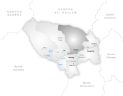
Karte Gemeinde Tamins 2007.png 1,181 × 925; 216 KB
-
Karte Gemeinde Tamins 2016.png 1,476 × 1,156; 370 KB
-
Karte Gemeinde Tamins.png 1,181 × 923; 181 KB
-
Kraftwerk Reichenau view towards Ems 01.jpg 3,072 × 2,304; 3.55 MB
-
Kraftwerk Reichenau view towards Ems 02.jpg 3,072 × 2,304; 3.6 MB
-
Kraftwerk Reichenau view towards Ems 03.jpg 3,072 × 2,304; 3.71 MB
-
Kraftwerk Reichenau view towards Ems 04.jpg 3,072 × 2,304; 3.29 MB
-
Kraftwerk Reichenau view towards Ems 05.jpg 3,072 × 2,304; 3.38 MB
-
Kraftwerk Reichenau view towards Ems 06.jpg 3,072 × 2,304; 3.64 MB
-
Kraftwerk Reichenau view towards Ems 07.jpg 3,072 × 2,304; 3.37 MB
-
Kraftwerk Reichenau view towards Ems 08.jpg 3,072 × 2,304; 3.51 MB
-
Kraftwerk Reichenau-Wehrbrücke über den Rhein, Tamins GR – Domat Ems GR 20170728-jag9889.jpg 4,608 × 3,456; 11.96 MB
-
Kunkelspass (1357 m) - panoramio.jpg 3,072 × 2,304; 3.13 MB
-
Kunkelspass - panoramio.jpg 2,048 × 1,536; 1.31 MB
-
Kunkelspass Filzstift - 1.jpg 4,032 × 3,024; 5.7 MB
-
Kunkelspass Filzstift - 10.jpg 4,032 × 3,024; 3.97 MB
-
Kunkelspass Filzstift - 11.jpg 4,032 × 3,024; 3.23 MB
-
Kunkelspass Filzstift - 12.jpg 4,032 × 3,024; 3.25 MB
-
Kunkelspass Filzstift - 13.jpg 4,032 × 3,024; 3.75 MB
-
Kunkelspass Filzstift - 14.jpg 4,032 × 3,024; 5.01 MB
-
Kunkelspass Filzstift - 15.jpg 4,032 × 3,024; 3.44 MB
-
Kunkelspass Filzstift - 16.jpg 4,032 × 3,024; 3.01 MB
-
Kunkelspass Filzstift - 17.jpg 4,032 × 3,024; 2.82 MB
-
Kunkelspass Filzstift - 18.jpg 4,032 × 3,024; 2.98 MB
-
Kunkelspass Filzstift - 19.jpg 4,032 × 3,024; 3.44 MB
-
Kunkelspass Filzstift - 2.jpg 4,032 × 3,024; 3.71 MB
-
Kunkelspass Filzstift - 20.jpg 4,032 × 3,024; 6.32 MB
-
Kunkelspass Filzstift - 21.jpg 3,024 × 4,032; 4.99 MB
-
Kunkelspass Filzstift - 22.jpg 4,032 × 3,024; 2.59 MB
-
Kunkelspass Filzstift - 23.jpg 4,032 × 3,024; 2.32 MB
-
Kunkelspass Filzstift - 24.jpg 4,032 × 3,024; 4.94 MB
-
Kunkelspass Filzstift - 25.jpg 4,032 × 3,024; 3.42 MB
-
Kunkelspass Filzstift - 26.jpg 4,032 × 3,024; 4.13 MB
-
Kunkelspass Filzstift - 3.jpg 4,032 × 3,024; 3.36 MB
-
Kunkelspass Filzstift - 4.jpg 4,032 × 3,024; 3.33 MB
-
Kunkelspass Filzstift - 5.jpg 3,024 × 4,032; 3.21 MB
-
Kunkelspass Filzstift - 6.jpg 4,032 × 3,024; 5.92 MB
-
Kunkelspass Filzstift - 7.jpg 4,032 × 3,024; 6.55 MB
-
Kunkelspass Filzstift - 8.jpg 4,032 × 3,024; 6.05 MB
-
Kunkelspass Filzstift - 9.jpg 3,024 × 4,032; 3.41 MB
-
Le Rhin au départ de Tamins.jpg 5,039 × 2,638; 10.28 MB
-
Near Taminser Calanda.jpg 2,592 × 1,456; 1.27 MB
-
Pfarramtsstempel Tamins.jpg 200 × 150; 11 KB
-
Reichenau Brückenbrand.jpg 1,681 × 2,239; 1,020 KB
-
Reichenau GR Bild Peter Birmann 1805.jpg 7,386 × 5,098; 3.34 MB
-
RhB Ge 4-4 I with freight and ABe 4-16 as S-Bahn at Reichenau-Tamins.jpg 5,066 × 3,375; 4.63 MB
-
RhB-Brücke über den Vorderrhein, Tamins GR – Bonaduz GR 20170714-jag9889.jpg 4,608 × 3,456; 10.69 MB
-
Rhäzüns und Calanda.jpg 2,560 × 1,920; 2.21 MB
-
Ringelspitz Kunkels Calanda.JPG 2,048 × 1,536; 702 KB
-
Roh-Tumein.ogg 1.8 s; 34 KB
-
Swissgas-Rohrträgerbrücke über den Rhein, Tamins GR – Domat Ems GR 20170728-jag9889.jpg 4,140 × 3,312; 8.96 MB
-
CHE Tamins COA.svg 227 × 265; 2 KB
-
Tamins - panoramio.jpg 2,304 × 3,072; 2.84 MB
-
Tamins Ansicht.jpg 3,456 × 2,304; 1.82 MB
-
Tamins von Kunkelspaßstraße.jpg 4,608 × 2,592; 2.62 MB
-
CHE Tamins COA alt.svg 600 × 700; 335 bytes
-
Tamins wappen.svg 438 × 480; 1 KB
-
Tamins Wappen.svg 438 × 480; 1 KB
-
Tamins01.JPG 1,600 × 1,200; 639 KB
-
Tamins02.JPG 1,600 × 1,200; 626 KB
-
Taminser Calanda 01.jpg 2,592 × 1,456; 1.03 MB
-
Taminser Calanda to south 01.jpg 2,592 × 1,456; 1.08 MB
-
Taminser Calanda view to south.jpg 2,592 × 1,944; 1.18 MB
-
Taminser Calanda.jpg 2,592 × 1,456; 963 KB
-
Taminser Älpli 01.jpg 2,592 × 1,456; 820 KB
-
Taminser Älpli 02.jpg 2,592 × 1,456; 972 KB
-
Taminser Älpli Buildings 01.jpg 2,592 × 1,456; 1 MB
-
Taminser Älpli towards Crap Mats.jpg 2,592 × 1,456; 1.08 MB
-
View to Taminser Calanda to south.jpg 2,592 × 1,456; 1.21 MB
-
Vorder hinterrhein.jpg 800 × 533; 35 KB
-
Vorderrheinbruecke Reichenau 01 11.jpg 1,575 × 1,049; 1.24 MB
-
Zusammenfluss - panoramio.jpg 1,024 × 741; 160 KB
-
Überuf - panoramio.jpg 2,048 × 1,536; 1.45 MB


