Category:Maps of the Napoleonic Wars
Jump to navigation
Jump to search
Subcategories
This category has the following 11 subcategories, out of 11 total.
2
7
B
I
P
Media in category "Maps of the Napoleonic Wars"
The following 103 files are in this category, out of 103 total.
-
174 of 'Geschichte Vinstgaus während der Kriegsjahre 1796-1801' (11062387995).jpg 1,459 × 2,355; 1.08 MB
-
179 of 'Geschichte Vinstgaus während der Kriegsjahre 1796-1801' (11062810373).jpg 1,205 × 2,073; 806 KB
-
2 campanha napoleao italia.jpg 1,437 × 1,409; 625 KB
-
77 of 'Napoléon et son temps ... Ouvrage illustré ... Neuvième mille' (11236496455).jpg 2,896 × 1,836; 1.55 MB
-
933 of 'Napoléon et son temps ... Ouvrage illustré ... Neuvième mille' (11238270166).jpg 1,785 × 1,458; 596 KB
-
Abukirpath.jpg 3,000 × 1,674; 869 KB
-
Alpes e passagens para bacia do Pó.jpg 900 × 700; 626 KB
-
Battle of Bassano 8 Sept 1796.JPG 866 × 735; 95 KB
-
Battle of Rovereto 4 Sept 1796.JPG 866 × 735; 98 KB
-
Bitva u Slavkova mapa.jpg 3,194 × 2,277; 3.06 MB
-
Bodleian Libraries, Wachsamkeit und Neid- Jeder will den grössten Theil.jpg 1,000 × 590; 89 KB
-
C. 1801-1812 Europe (treaty adjustments).jpg 1,356 × 1,099; 1.25 MB
-
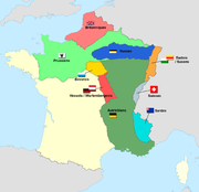
Carte d'occupation France 1815-es.svg 2,000 × 1,898; 388 KB
-
Carte d'occupation france 1815.jpg 614 × 620; 36 KB
-
Carte d'occupation france 1815.png 1,439 × 1,392; 283 KB
-
Carte d'occupation France 1815.svg 2,000 × 1,898; 392 KB
-
Carte du théâtre de la Guerre (34382295026).jpg 1,000 × 803; 168 KB
-
Carte été 1813.svg 706 × 658; 335 KB
-
Continental Blockade (1812).svg 450 × 456; 611 KB
-
EB1911-19-0218-a-Napolonic Campaigns, Campaigns in German 1796-1809.jpg 1,086 × 922; 1.01 MB
-
Europa Central 1799.jpg 1,399 × 1,899; 1.62 MB
-
Europa w czasach Napoleona (Ultima Thule).png 781 × 602; 1.01 MB
-
Europe in 1812.PNG 536 × 399; 458 KB
-
Europe map 1812-es.svg 2,256 × 1,845; 1.1 MB
-
Europe map 1812.PNG 800 × 565; 120 KB
-
Europe map Napoleon 1811.png 415 × 397; 62 KB
-
Europe map Napoleon 1811.svg 415 × 422; 89 KB
-
Europe map Napoleon Blocus.png 415 × 397; 67 KB
-
Europe map Napoleon Blocus.svg 450 × 456; 659 KB
-
F L Petre Battle of Halle Map.JPG 880 × 590; 127 KB
-
First of June 1794 Map.png 431 × 522; 12 KB
-
Flag map of The French campaign in Egypt and Syria.png 692 × 788; 75 KB
-
Fontainebleau1807.pdf 714 × 1,260; 229 KB
-
Germany, 1813 - Situation, 2 October and Major Movements Since 26 September.svg 1,112 × 860; 824 KB
-
Invasion of France in 1815.jpg 1,827 × 2,368; 3.61 MB
-
Italian campaigns 1796.JPG 873 × 669; 448 KB
-
Italy after the treaty of Campo Formio.png 8,452 × 9,025; 3.55 MB
-
Jena-Auerstedt 1806 Campaign Map.JPG 548 × 390; 37 KB
-
Map Austria in the napoleonic age 1928-1940 - Touring Club Italiano CART-TRC-61.jpg 5,056 × 6,579; 3.63 MB
-
Map Napoleon Total War.png 824 × 559; 343 KB
-
Map to illustrate Campaign of 1805 and Earlier - Pg-217.jpg 1,003 × 743; 229 KB
-
Mapa Europy 1812-14 BEL.png 800 × 565; 117 KB
-
Meyers Hist Handatlas 1911 Nr 33.jpg 3,692 × 2,972; 2.19 MB
-
Nap49.jpg 1,233 × 954; 195 KB
-
Napoleon's Retreat from Moscow 18 October through 5 December 1812.png 1,157 × 901; 310 KB
-
Napoleonic Wars War of the Fourth Coalition.png 1,357 × 648; 46 KB
-
Napoleonic Wars War of the Seventh Coalition.png 1,357 × 628; 35 KB
-
Napoleonic Wars War of the Sixth Coalition.png 1,357 × 628; 34 KB
-
Napoleonic Wars War of the Third Coalition.png 1,357 × 628; 35 KB
-
NapoleonicWars.png 1,357 × 628; 52 KB
-
NapoleonischeZeit.1.jpg 2,820 × 3,612; 4.56 MB
-
N° 72 DANTZIG.jpg 5,443 × 4,021; 5.27 MB
-
Part of Belgium engraved by J. Kirkwood.jpg 3,174 × 2,029; 4.66 MB
-
Plan of the battle of Issy 1815 (1837).jpg 1,346 × 1,477; 869 KB
-
Prenzlau-Lubeck 1806 Campaign Map.JPG 760 × 580; 81 KB
-
Preussen-1806-es.svg 12,043 × 6,256; 2.23 MB
-
Preussen-1806.jpg 1,000 × 502; 187 KB
-
RevolutionaryandNapoleonicWars.png 1,380 × 630; 35 KB
-
Russian map of Poland in 1806-07.jpg 1,523 × 1,763; 268 KB
-
Spruner-Menke Handatlas 1880 Karte 11 Nebenkarte 3 (cropped1).jpg 2,018 × 2,040; 482 KB
-
Spruner-Menke Handatlas 1880 Karte 11 Nebenkarte 3.jpg 2,186 × 2,217; 551 KB
-
Spruner-Menke Handatlas 1880 Karte 11.jpg 10,225 × 8,737; 19.58 MB
-
Strategic Situation of Europe 1801.jpg 1,260 × 970; 819 KB
-
Strategic Situation of Europe 1803.jpg 1,260 × 970; 201 KB
-
Strategic Situation of Europe 1805.jpg 1,260 × 970; 202 KB
-
Strategic Situation of Europe 1806.jpg 1,256 × 961; 208 KB
-
Strategic Situation of Europe 1807.jpg 1,236 × 953; 204 KB
-
Strategic Situation of Europe 1808.jpg 1,260 × 965; 213 KB
-
Strategic Situation of Europe 1809.jpg 1,260 × 965; 209 KB
-
Strategic Situation of Europe 1812.jpg 1,239 × 936; 238 KB
-
Strategic Situation of Europe 1813.jpg 1,233 × 942; 210 KB
-
Strategic Situation of Western Europe 1814 (cropped to 1 january).jpg 624 × 963; 127 KB
-
Strategic Situation of Western Europe 1814 (cropped to 10 Feb).jpg 618 × 963; 120 KB
-
Strategic Situation of Western Europe 1814.jpg 1,242 × 963; 229 KB
-
Strategic Situation of Western Europe 1815.jpg 1,260 × 975; 358 KB
-
Treaty of Fontainebleau 1807 de.svg 380 × 690; 275 KB
-
Treaty of Fontainebleau 1807 es.svg 380 × 690; 351 KB
-
Vienna and vicinity, 22 May 1809.jpg 1,227 × 945; 248 KB
-
Wagram and vicinity, 5 July 1809.jpg 1,242 × 948; 243 KB
-
War of the Sixth Coalition 1813.svg 450 × 456; 479 KB
-
Westeuropa BV044859944.jpg 4,500 × 3,991; 2.79 MB
-
حرب التحالف الثالث.jpg 2,500 × 2,037; 1.59 MB


