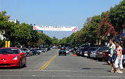
Category:Los Altos, California
Jump to navigation
Jump to search
city in Santa Clara County, California, United States | |||||
| Upload media | |||||
| Instance of | |||||
|---|---|---|---|---|---|
| Location | Santa Clara County, California, Pacific States Region | ||||
| Head of government |
| ||||
| Inception |
| ||||
| Population |
| ||||
| Area |
| ||||
| Elevation above sea level |
| ||||
| official website | |||||
 | |||||
Subcategories
This category has the following 12 subcategories, out of 12 total.
Media in category "Los Altos, California"
The following 64 files are in this category, out of 64 total.
-
12 KwH system wakes up - panoramio.jpg 3,072 × 2,304; 3.58 MB
-
3 5000 Watt Inverters - panoramio.jpg 4,272 × 2,848; 4.18 MB
-
4600 El Camino Los Altos demolition after Christmas 2023 fire.jpg 3,729 × 1,418; 3.64 MB
-
Aerial photograph of Los Altos, CA 2.jpg 4,096 × 1,940; 3.74 MB
-
Aerial photograph of Los Altos, CA.jpg 4,096 × 1,940; 3.74 MB
-
Architect and engineer (1922) (14594595207).jpg 578 × 836; 173 KB
-
Blach - Fur Traders.jpg 1,880 × 1,315; 309 KB
-
Black Mountain summit.jpg 3,552 × 2,000; 1.09 MB
-
CAMap-doton-Los Altos Hills.png 209 × 230; 4 KB
-
CAMap-doton-Los Altos.png 209 × 230; 4 KB
-
Country Club Area, Los Altos, CA.jpg 6,000 × 4,000; 6.54 MB
-
Fairway, Los Altos, CA March 2024.jpg 6,000 × 4,000; 6.9 MB
-
Fenced path curving downhill - panoramio.jpg 3,648 × 2,736; 3.94 MB
-
Flag of Los Altos, California.gif 360 × 216; 25 KB
-
Foothill Expressway.jpg 568 × 288; 117 KB
-
Front Sign of Blach Intermediate School.jpg 1,170 × 652; 258 KB
-
Hale creek los altos.jpg 4,608 × 3,456; 2.63 MB
-
Hidden Villa bridge 2010.jpg 720 × 1,280; 837 KB
-
Hotel Room with queen size bed.jpg 4,320 × 2,432; 2.65 MB
-
LAHS marchband.jpg 4,288 × 2,848; 1.82 MB
-
Los Altos entrance sign 2a.jpg 800 × 628; 229 KB
-
Los Altos Main Street 2.jpg 800 × 508; 236 KB
-
Losaltoshillsview.jpg 800 × 437; 186 KB
-
Loyola, Los Altos, CA March 2024.jpg 6,000 × 4,000; 5.68 MB
-
Now a net power producer - CA setting the pace for green economy - panoramio (1).jpg 3,072 × 2,304; 4.31 MB
-
Now a net power producer - CA setting the pace for green economy - panoramio (2).jpg 3,072 × 2,304; 2.69 MB
-
Now a net power producer - CA setting the pace for green economy - panoramio.jpg 3,072 × 2,304; 2.16 MB
-
Open space trail entrance - panoramio.jpg 3,648 × 2,736; 4.04 MB
-
Pinewood School.jpg 686 × 306; 49 KB
-
Post office drivethrough lane.jpg 1,000 × 620; 229 KB
-
Purisima Creek above O'Keefe Lane with water & alders Aug. 29, 2010.jpg 1,536 × 2,048; 1.87 MB
-
Purisima Creek entering Los Altos.jpg 1,498 × 2,123; 1.38 MB
-
Redwood Grove logs to mill.jpg 1,512 × 2,482; 1.53 MB
-
Seal of Los Altos, California.png 400 × 400; 253 KB
-
Solar prep - be ready - panoramio (1).jpg 4,272 × 2,848; 5.7 MB
-
Solar prep - be ready - panoramio (3).jpg 3,072 × 2,304; 2.33 MB
-
Solar prep - be ready - panoramio (4).jpg 3,072 × 2,304; 2.54 MB
-
Solar prep - be ready - panoramio (7).jpg 3,072 × 2,304; 2.64 MB
-
Solar prep - be ready - panoramio.jpg 4,272 × 2,848; 3.67 MB
-
Tracteur vigneron John Deere dans une vigne en hautain.jpg 2,816 × 2,112; 3.35 MB
-
Vendanges à Los Altos sur un vignoble de chardonnay conduit en hautain.jpg 2,112 × 2,816; 3.51 MB
-
Waldorf school, Los Altos - panoramio (1).jpg 4,912 × 3,264; 5.3 MB
-
Wildcat Loop Trail - panoramio.jpg 2,448 × 3,264; 2.71 MB
-
Winchester Farmhouse in Los Altos.jpg 4,160 × 3,120; 3.86 MB
-
Woodland Library.jpg 4,000 × 3,000; 2.65 MB
-
Zero Carbon Footprint - panoramio (1).jpg 4,272 × 2,848; 6.55 MB
-
Zero Carbon Footprint - panoramio (2).jpg 4,272 × 2,848; 7.07 MB
-
Zero Carbon Footprint - panoramio (3).jpg 4,272 × 2,848; 5.39 MB
-
Zero Carbon Footprint - panoramio (4).jpg 4,272 × 2,848; 6.94 MB
-
Zero Carbon Footprint - panoramio (6).jpg 4,272 × 2,848; 5.84 MB
-
Zero Carbon Footprint - panoramio (7).jpg 4,272 × 2,848; 7.2 MB
-
Zero Carbon Footprint - panoramio (8).jpg 4,272 × 2,848; 7.52 MB
-
Zero Carbon Footprint - panoramio (9).jpg 4,272 × 2,848; 5.7 MB


