Category:Kincasslagh
Jump to navigation
Jump to search
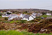
English: Kincasslagh (official name: Cionn Caslach; Ceann Caslach locally, meaning "The head of the small inlet.".) is a small seaside village in the Rosses area, in northwest Ireland, consisting of a pub, an art gallery, a shop and post office.
Gaeilge: Is sráidbhaile é Cionn Caslach nó Ceann Caslach (Béarla: Kincasslagh) atá suite i n Gaeltacht Dhún na nGall, Poblacht na hÉireann. Tagann an ceoltóir cáiliúil Daniel O'Donnell agus a dheirfiúr Margo ón mbaile.
village in Ulster, Ireland | |||||
| Upload media | |||||
| Instance of | |||||
|---|---|---|---|---|---|
| Location | County Donegal, Ulster, Ireland | ||||
 | |||||
Subcategories
This category has the following 5 subcategories, out of 5 total.
Media in category "Kincasslagh"
The following 84 files are in this category, out of 84 total.
-
Annagry East - geograph.org.uk - 2424514.jpg 640 × 480; 75 KB
-
Bust, Cardinal Tomás Ó Fiaich - geograph.org.uk - 2424525.jpg 640 × 480; 45 KB
-
Bust, Rinnafarset - geograph.org.uk - 2424519.jpg 640 × 480; 61 KB
-
Calhame, Annagry - geograph.org.uk - 2424421.jpg 640 × 480; 65 KB
-
Commemoration stone and field - geograph.org.uk - 2424628.jpg 640 × 480; 38 KB
-
Commemoration stone, Mullaghduff - geograph.org.uk - 2424640.jpg 640 × 481; 95 KB
-
Kincasslagh - Atlantic Ocean bay - geograph.org.uk - 1170214.jpg 640 × 426; 294 KB
-
Kincasslagh - Atlantic Ocean bay - geograph.org.uk - 1170223.jpg 640 × 425; 258 KB
-
Kincasslagh - geograph.org.uk - 501541.jpg 640 × 479; 63 KB
-
Kincasslagh - View of Atlantic Ocean bay - geograph.org.uk - 1170220.jpg 426 × 639; 319 KB
-
Kincasslagh - View of Atlantic Ocean bay - geograph.org.uk - 1170227.jpg 640 × 426; 291 KB
-
Kincasslagh Peninsula - Building - geograph.org.uk - 1338579.jpg 640 × 426; 106 KB
-
Kincasslagh Peninsula - Main road - geograph.org.uk - 1171554.jpg 639 × 426; 310 KB
-
Kincasslagh Peninsula - Pier at NW end - geograph.org.uk - 1171541.jpg 639 × 426; 333 KB
-
Kincasslagh Post office - geograph.org.uk - 52747.jpg 512 × 383; 53 KB
-
Kincasslagh2.JPG 2,048 × 1,536; 1.54 MB
-
Mullaghdearg Beach - geograph.org.uk - 4007030.jpg 640 × 355; 291 KB
-
Mullaghderg Lough - geograph.org.uk - 2424434.jpg 640 × 480; 66 KB
-
R259, Calhame - geograph.org.uk - 2424427.jpg 640 × 480; 50 KB
-
R259, Mullaghduff - geograph.org.uk - 2424615.jpg 640 × 480; 47 KB
-
Road and view at Rinnafarset - geograph.org.uk - 2424541.jpg 640 × 480; 64 KB
-
Road at Annagry East - geograph.org.uk - 2424510.jpg 640 × 480; 54 KB
-
Road at Derrymancher - geograph.org.uk - 2424543.jpg 640 × 480; 51 KB
-
Road at Derrymancher - geograph.org.uk - 2424545.jpg 640 × 480; 60 KB
-
Road at Mullaghderg - geograph.org.uk - 2424441.jpg 640 × 480; 72 KB
-
Road at Mullaghderg - geograph.org.uk - 2424446.jpg 640 × 480; 58 KB
-
Shrine, Rinnafarset - geograph.org.uk - 2424536.jpg 640 × 480; 62 KB
-
The Rosses area - Cottage along R257 - geograph.org.uk - 1332783.jpg 640 × 426; 104 KB
-
The Rosses area - Cottage off R257 - geograph.org.uk - 1332789.jpg 640 × 427; 91 KB


