Category:French-language SVG maps
Jump to navigation
Jump to search
Subcategories
This category has the following 9 subcategories, out of 9 total.
C
F
Media in category "French-language SVG maps"
The following 200 files are in this category, out of 1,373 total.
(previous page) (next page)-
2001 Macedonia insurgency-fr.svg 1,400 × 1,130; 179 KB
-
2017-04-07 Stockholm attacks fr.svg 1,001 × 1,071; 1.84 MB
-
2017-08-17 Barcelona attacks fr.svg 760 × 1,074; 3.75 MB
-
3emeCirconscription.svg 466 × 541; 7 KB
-
Aavasaksa topographic map-fr.svg 1,368 × 1,688; 256 KB
-
Abisko national park map-fr.svg 1,206 × 1,048; 4.02 MB
-
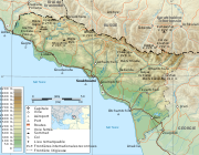
Abkhazia map-fr.svg 945 × 737; 813 KB
-
Acadia 1604-1607 topographic map-fr.svg 700 × 640; 422 KB
-
Acadia 1610-1613 topographic map-fr.svg 546 × 403; 553 KB
-
Acris crepitans 2 map-fr.svg 1,000 × 600; 326 KB
-
Acris crepitans map-fr.svg 945 × 653; 334 KB
-
Acris gryllus map-fr.svg 945 × 653; 302 KB
-
Adelophryne maranguapensis map-fr.svg 1,000 × 600; 287 KB
-
Adelophryne pachydactyla map-fr.svg 1,000 × 600; 304 KB
-
Adelophryne patamona map-fr.svg 1,000 × 600; 308 KB
-
Adelphobates castaneoticus map-fr.svg 1,000 × 600; 319 KB
-
Adelphobates galactonotus map-fr.svg 1,000 × 600; 302 KB
-
Adelphobates quinquevittatus map-fr.svg 1,000 × 600; 319 KB
-
Adenomus kelaartii map-fr.svg 1,000 × 600; 267 KB
-
AdministrativeDivisionOfMacao-fr.svg 600 × 811; 235 KB
-
Aeolian Islands map-fr.svg 735 × 536; 597 KB
-
Affaire Louis Mailloux.svg 1,210 × 482; 49 KB
-
African Great Lakes fr.svg 765 × 990; 833 KB
-
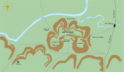
Agde - Plan du fort Brescou 1790.svg 3,007 × 1,944; 105 KB
-
AJ Auxerre et ses clubs voisins map-fr.svg 1,081 × 802; 115 KB
-
Albania map-fr.svg 1,880 × 3,850; 6.85 MB
-
Albericus brunhildae map-fr.svg 670 × 400; 386 KB
-
Aldabra islands seychelles-fr.svg 990 × 502; 302 KB
-
Alençon Alto public transport 2007 map-fr.svg 1,417 × 1,417; 250 KB
-
Alençon Alto public transport map-fr.svg 1,080 × 1,080; 103 KB
-
Allobates fuscellus map-fr.svg 1,000 × 600; 331 KB
-
Alps-Mediterranean Euroregion map-fr.svg 1,465 × 1,126; 344 KB
-
Amazonrivermap fr.svg 1,000 × 1,000; 808 KB
-
Ambelau Island-fr.svg 771 × 565; 100 KB
-
Amolops cucae map-fr.svg 1,000 × 600; 321 KB
-
Amolops gerbillus map-fr.svg 1,000 × 600; 402 KB
-
Amolops minutus map-fr.svg 1,000 × 600; 321 KB
-
Amolops spinapectoralis map-fr.svg 1,000 × 600; 291 KB
-
Amolops splendissimus map-fr.svg 1,000 × 600; 317 KB
-
Anahim Volcanic Belt-fr.svg 2,334 × 832; 817 KB
-
Andorra topographic map-fr.svg 1,625 × 1,300; 1.58 MB
-
Anglo American War 1812 Locations map-fr.svg 1,494 × 830; 206 KB
-
Angouleme location map.svg 886 × 744; 5.66 MB
-
Anjouan topographic map-fr.svg 841 × 687; 764 KB
-
Anodonthyla boulengerii map-fr.svg 545 × 533; 458 KB
-
Antarctic fr.svg 502 × 619; 3.64 MB
-
Antarctica Farthest Souths-fr.svg 1,144 × 1,289; 94 KB
-
Antarctica-ru.svg 512 × 511; 669 KB
-
Antarctica.svg 512 × 511; 655 KB
-
Antemnae.svg 1,935 × 1,128; 72 KB
-
Apollo 11 photo map-fr.svg 709 × 709; 988 KB
-
Aral map-fr.svg 991 × 680; 1.04 MB
-
Arc de Berà - Localisation-fr.svg 1,701 × 1,448; 42 KB
-
Arctic-fr.svg 505 × 633; 1.59 MB
-
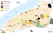
Arles centre-ville map-fr.svg 1,450 × 920; 209 KB
-
Arles general map-fr.svg 1,150 × 1,300; 36 KB
-
Armorican Massif geological map-fr.svg 1,770 × 1,300; 981 KB
-
Arnica Montana Culture In Scotland-fr.svg 1,024 × 716; 513 KB
-
Around Alone 1998-1999 map-fr.svg 3,040 × 1,396; 418 KB
-
Around Alone 2002 map-fr.svg 3,040 × 1,396; 421 KB
-
Arques drainage basin-fr.svg 2,258 × 1,975; 2 MB
-
Arquipélago das Berlengas-fr.svg 1,643 × 2,743; 209 KB
-
Arrondissements et cantons d'Ille-et-Vilaine.svg 745 × 1,050; 183 KB
-
Arrondissements et cantons des Cotes-d'Armor.svg 711 × 544; 126 KB
-
Arrondissements et cantons du Finistère.svg 1,310 × 1,220; 192 KB
-
Ascophyllum nodosum distribution map-fr.svg 1,048 × 931; 1.05 MB
-
Asie-fr.svg 1,100 × 837; 968 KB
-
Assa darlingtoni map-fr.svg 1,000 × 600; 284 KB
-
Assam Tinsukia locator map.svg 419 × 565; 317 KB
-
Asterophrys turpicola map-fr.svg 670 × 400; 395 KB
-
Atomic bomb 1945 mission map-fr.svg 2,111 × 2,663; 316 KB
-
Aube regions map-fr.svg 540 × 394; 78 KB
-
Philippines Aurora District locator map-fr.svg 1,148 × 1,756; 260 KB
-
Australian renewable power plants map-fr.svg 1,146 × 808; 1.32 MB
-
Austria-Hungary-fr.svg 1,898 × 1,385; 85 KB
-
Austrochaperina derongo map-fr.svg 670 × 400; 386 KB
-
Austrochaperina guttata map-fr.svg 670 × 400; 386 KB
-
Austrochaperina macrorhyncha map-fr.svg 670 × 400; 390 KB
-
Austrochaperina palmipes map-fr.svg 670 × 400; 390 KB
-
Austrochaperina rivularis map-fr.svg 670 × 400; 385 KB
-
Average US Residential Price of Electricity by State fr.svg 990 × 627; 305 KB
-
Azerbaijan topographic map-fr.svg 757 × 502; 3.07 MB
-
Baarle-Nassau - Baarle-Hertog-fr.svg 1,700 × 1,700; 259 KB
-
Bahrain map-fr.svg 1,170 × 1,575; 687 KB
-
Baie de l'Amirauté.svg 1,349 × 1,410; 490 KB
-
Baie des Cochons locator map.svg 851 × 344; 623 KB
-
Balkan topo fr.svg 1,400 × 1,278; 466 KB
-
Banks Islands-fr.svg 1,002 × 1,508; 323 KB
-
Baserefl composite comparison fr.svg 1,141 × 543; 1.18 MB
-
Bataille de Lipari - Préparatifs et mouvements-fr.svg 1,214 × 656; 193 KB
-
Battaglia dello Scire.svg 932 × 1,462; 3.39 MB
-
Battle of Cape Ecnomus-fr.svg 7,056 × 6,390; 37 KB
-
Battle of Donetsk Airport (fr).png 2,398 × 1,478; 813 KB
-
Battle of Drepana-fr.svg 6,964 × 7,036; 135 KB
-
Battle of lake trasimene-fr.svg 1,286 × 989; 46 KB
-
Battle of Malakoff map fr.svg 7,312 × 4,887; 1.62 MB
-
Battle of Quiberon Bay - 1759 - Tracks map-fr.svg 670 × 912; 127 KB
-
Battle of Red Cliffs 208 extended map-fr.svg 782 × 591; 755 KB
-
Battle of the Gebora-fr.svg 1,450 × 1,185; 114 KB
-
Bavay map-fr.svg 671 × 495; 1.94 MB
-
Bay-of-Piran maritime-boundary-dispute-fr.svg 789 × 735; 36 KB
-
Bayern-Regierungsbezirke-FR.svg 1,227 × 1,236; 81 KB
-
Bayeux - Plan à l'époque romaine.svg 3,489 × 2,352; 78 KB
-
Belgique hydrographie.svg 1,449 × 1,178; 35 KB
-
Belize, administrative divisions - fr - monochrome.svg 788 × 1,092; 179 KB
-
Belle-Île-en-Mer administrative map-fr.svg 1,118 × 878; 1.16 MB
-
Berlengas archipelago geology-fr.svg 1,183 × 1,593; 77 KB
-
Berlengas-fr.svg 1,500 × 1,219; 193 KB
-
Biafra independent state map-fr.svg 1,100 × 850; 445 KB
-
Björnlandet national park map-fr.svg 1,431 × 946; 2.73 MB
-
Bjørnøya map-fr.svg 2,195 × 2,653; 1.79 MB
-
Bohai map-fr.svg 320 × 335; 85 KB
-
Bouclier guyanais.svg 1,500 × 1,200; 59 KB
-
Boundaries in the Arctic - map-fr.svg 1,335 × 1,335; 969 KB
-
Bourg de Joué-sur-Erdre.svg 1,755 × 928; 111 KB
-
Brachytarsophrys intermedia map-fr.svg 1,000 × 600; 293 KB
-
Breuschstellung-map-fr.svg 1,047 × 1,167; 497 KB
-
Bulgaria-geographic map-fr.svg 2,483 × 1,642; 5.23 MB
-
Burghs of Dabíd mac Maíl Choluim-fr.svg 416 × 621; 92 KB
-
Byzantine Empire Themata-950-fr.svg 747 × 455; 185 KB
-
Cabezo de Alcalá aerial view-fr.svg 1,577 × 1,018; 137 KB
-
Cabinda map-fr.svg 977 × 1,290; 206 KB
-
Calluella guttulata map-fr.svg 750 × 750; 506 KB
-
Callulops personatus map-fr.svg 670 × 400; 388 KB
-
Callulops robustus map-fr.svg 670 × 400; 438 KB
-
Callulops slateri map-fr.svg 670 × 400; 388 KB
-
Callulops stictogaster map-fr.svg 670 × 400; 388 KB
-
Callulops wilhelmanus map-fr.svg 670 × 400; 388 KB
-
Quebec Map with Hydro-Québec infrastructures-fr.svg 1,261 × 1,563; 1.6 MB
-
Quebec province topographic map-fr.svg 1,261 × 1,563; 956 KB
-
Quebec province transportation and cities map-fr.svg 1,261 × 1,563; 1.85 MB
-
Canton de Lannion position dans les Cotes-d'Armor.svg 711 × 544; 134 KB
-
Canton-Beaugency-2014.svg 1,452 × 1,117; 755 KB
-
Canton-Loiret-2014-Gien-details.svg 1,452 × 1,117; 688 KB
-
Canton-Loiret-2014-Gien.svg 1,452 × 1,117; 830 KB
-
Cantons-Loiret-2014.svg 1,463 × 1,110; 567 KB
-
Cap Tourmente map-fr.svg 949 × 684; 328 KB
-
Caponniere.svg 1,120 × 1,050; 1.48 MB
-
Capri and Ischia map-fr.svg 802 × 541; 599 KB
-
Carib Territory-fr.svg 1,406 × 1,116; 27 KB
-
Mapa del Mar Caribe (límites marinos)-fr.svg 3,587 × 2,221; 1.91 MB
-
Carrière des Nerviens (alentours)-fr.svg 1,021 × 1,140; 2.27 MB
-
Carte administrative de l'Acadie.svg 2,700 × 2,106; 1.34 MB
-
Carte administrative du Canada.svg 1,280 × 1,128; 234 KB
-
Carte Amitom.svg 2,453 × 1,286; 312 KB
-
Carte Auckland Region-fr.svg 724 × 805; 1.14 MB
-
Carte Auschwitz.svg 3,079 × 2,623; 227 KB
-
Carte baie Howe.svg 1,093 × 921; 94 KB
-
Carte baie Nootka.svg 566 × 725; 85 KB
-
Carte baies Desolation et Bute.svg 959 × 909; 64 KB
-
Carte Bas-Caraquet fr.svg 850 × 666; 367 KB
-
Carte d'Akrotiri et Dhekelia.svg 702 × 411; 148 KB
-
Carte de Chypre.svg 702 × 411; 167 KB
-
Carte de la Bèze.svg 1,395 × 2,790; 3.02 MB
-
Carte de La Demenure (Joué-sur-Erdre).svg 1,751 × 1,220; 142 KB
-
Carte de la Mulonnière (Joué-sur-Erdre).svg 912 × 507; 51 KB
-
Carte de la Sarine.svg 512 × 512; 25 KB
-
Carte de la station Arctowski.svg 744 × 739; 159 KB
-
Carte de localisation - Sites de Heurtries II et La Gohaigne (Quetteville).svg 3,367 × 3,620; 144 KB
-
Carte des transports en communs entre les bibliothèques de Rennes.svg 1,500 × 1,800; 2.24 MB
-
Carte des îles Chausey.svg 996 × 486; 338 KB
-
Carte des Îles Pitcairn.svg 500 × 495; 48 KB
-
Carte Detail port spatial de Kourou.svg 750 × 1,030; 93 KB
-
Carte du Moyen-Orient.svg 942 × 1,110; 5.15 MB
-
Carte du Moyen-Orient2.svg 936 × 900; 5.15 MB
-
Carte Iles Discovery.svg 1,888 × 924; 166 KB
-
Carte Miscou.svg 1,150 × 1,230; 341 KB
-
Carte parc de Sonfjället.svg 1,177 × 899; 2.43 MB
-
Carte parc national de Tiveden.svg 1,454 × 1,018; 1,016 KB
-
Carte Pokemouche 2.svg 1,275 × 999; 389 KB
-
Carte Pokemouche.svg 1,061 × 745; 667 KB
-
Carte pop urb 2017.svg 1,600 × 1,086; 1.32 MB
-
Carte populations salish de la cote.svg 1,120 × 588; 157 KB
-
Carte simplifiée baie Jervis.svg 826 × 882; 128 KB
-
Carte simplifiée ile Gabriola.svg 1,662 × 921; 64 KB
-
Carte Store Mosse.svg 1,007 × 1,167; 2.28 MB
-
Carte topo Caraquet.svg 1,275 × 999; 436 KB
-
Carte topographique Baie-du-Petit-Pokemouche fr.svg 1,275 × 999; 1.15 MB
-
Carte topographique Bathurst fr.svg 1,150 × 800; 444 KB
-
Carte topographique Chiasson-Savoy fr.svg 1,275 × 999; 1.15 MB
-
Carte topographique de la Bèze.svg 1,395 × 2,790; 5.23 MB
-
Carte topographique du Japon-fr.svg 2,322 × 2,107; 3.91 MB
-
Carte topographique Grande-Anse.svg 1,275 × 999; 122 KB
-
Carte topographique Haut-Lamèque fr.svg 1,275 × 999; 284 KB
-
Carte topographique Haut-Shippagan fr.svg 1,275 × 999; 1.15 MB
-
Carte topographique Lamèque fr.svg 1,275 × 999; 284 KB
-
Carte topographique Le Goulet fr.svg 1,275 × 999; 1.15 MB
-
Carte topographique Nouvelle-Écosse de-William Alexander 1632.svg 2,928 × 2,106; 723 KB
-
Carte topographique Paquetville.svg 1,275 × 999; 179 KB
-
Carte topographique Paroisse de Paquetville.svg 1,275 × 999; 182 KB
-
Carte topographique Pointe-Brûlée fr.svg 1,275 × 999; 1.15 MB
-
Carte topographique Pointe-Sauvage fr.svg 1,275 × 999; 1.15 MB
-
Carte topographique Shippagan fr.svg 1,275 × 999; 1.15 MB
-
Carte Île-d'Aix.svg 736 × 747; 72 KB
-
CarteBouctouche.svg 850 × 666; 262 KB
-
CarteRoute53.svg 500 × 517; 65 KB
-
CarteRoute72.svg 501 × 514; 101 KB
-
Cascade Range major volcanoes topographic map-fr.svg 403 × 693; 15.91 MB
-
Cascade Range map protected areas map-fr.svg 403 × 693; 3.63 MB


