Taliwang
Appearance
Taliwang | |
|---|---|
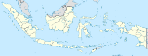
 Location of West Sumbawa Regency in West Nusa Tenggara | |
| Coordinates: 08°44′01″S 116°52′00″E / 8.73361°S 116.86667°E | |
| Country | Indonesia |
| Province | West Nusa Tenggara |
| Regency | West Sumbawa Regency |
| Area | |
| • Total | 153.71 km2 (59.35 sq mi) |
| Population (mid 2023 estimate) | |
| • Total | 57,540 |
| • Density | 370/km2 (970/sq mi) |
| [1] | |
| Time zone | UTC+8 |
| License plate | EA |
| Website | www.sumbawabaratkab.go.id |
Taliwang is the regency seat of West Sumbawa Regency, on the western coast of the island of Sumbawa. It is the fifth largest town on the island of Sumbawa, with a population of 44,136 at the 2010 Census[2] and 55,340 at the 2020 Census;[3] the official estimate as at mid 2023 was 57,540.[1]
Geography
[edit]The town is located on the western coast of the Sumbawa island.
Climate
[edit]Taliwang has a tropical savanna climate (Aw) with moderate to little rainfall from April to October and heavy rainfall from November to March.
| Climate data for Taliwang | |||||||||||||
|---|---|---|---|---|---|---|---|---|---|---|---|---|---|
| Month | Jan | Feb | Mar | Apr | May | Jun | Jul | Aug | Sep | Oct | Nov | Dec | Year |
| Mean daily maximum °C (°F) | 30.3 (86.5) |
30.2 (86.4) |
30.7 (87.3) |
31.1 (88.0) |
30.7 (87.3) |
30.1 (86.2) |
29.7 (85.5) |
30.2 (86.4) |
30.8 (87.4) |
31.1 (88.0) |
30.7 (87.3) |
30.4 (86.7) |
30.5 (86.9) |
| Daily mean °C (°F) | 26.2 (79.2) |
26.2 (79.2) |
26.4 (79.5) |
26.3 (79.3) |
25.7 (78.3) |
24.9 (76.8) |
24.3 (75.7) |
24.6 (76.3) |
25.4 (77.7) |
26.0 (78.8) |
26.3 (79.3) |
26.3 (79.3) |
25.7 (78.3) |
| Mean daily minimum °C (°F) | 22.2 (72.0) |
22.3 (72.1) |
22.2 (72.0) |
21.5 (70.7) |
20.7 (69.3) |
19.7 (67.5) |
18.9 (66.0) |
19.1 (66.4) |
20.1 (68.2) |
21.0 (69.8) |
22.0 (71.6) |
22.2 (72.0) |
21.0 (69.8) |
| Average rainfall mm (inches) | 254 (10.0) |
177 (7.0) |
158 (6.2) |
111 (4.4) |
75 (3.0) |
41 (1.6) |
27 (1.1) |
25 (1.0) |
33 (1.3) |
79 (3.1) |
180 (7.1) |
284 (11.2) |
1,444 (57) |
| Source: Climate-Data.org[4] | |||||||||||||
Sister cities
[edit]Kulim, Malaysia
