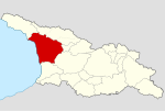
File:Historical Imereti in modern international borders of Georgia.svg
From Wikimedia Commons, the free media repository
Jump to navigation
Jump to search

Size of this PNG preview of this SVG file: 800 × 538 pixels. Other resolutions: 320 × 215 pixels | 640 × 430 pixels | 1,024 × 688 pixels | 1,280 × 860 pixels | 2,560 × 1,720 pixels | 942 × 633 pixels.
Original file (SVG file, nominally 942 × 633 pixels, file size: 345 KB)
File information
Structured data
Captions
Captions
Add a one-line explanation of what this file represents
Summary
[edit]| DescriptionHistorical Imereti in modern international borders of Georgia.svg |
English: Historical Imereti in modern international borders of Georgia
ქართული: იმერეთის ისტორიული საზღვრები საქართველოს თანამედროვე საერთაშორისო საზღვრებში
Русский: Исторические границы Имерети в современных международных границах Грузии
|
||
| Date | |||
| Source |
Data is based on various sources - text materials and historical maps.
|
||
| Author | Giorgi Balakhadze |
Licensing
[edit]I, the copyright holder of this work, hereby publish it under the following license:
This file is licensed under the Creative Commons Attribution-Share Alike 4.0 International license.
- You are free:
- to share – to copy, distribute and transmit the work
- to remix – to adapt the work
- Under the following conditions:
- attribution – You must give appropriate credit, provide a link to the license, and indicate if changes were made. You may do so in any reasonable manner, but not in any way that suggests the licensor endorses you or your use.
- share alike – If you remix, transform, or build upon the material, you must distribute your contributions under the same or compatible license as the original.
File history
Click on a date/time to view the file as it appeared at that time.
| Date/Time | Thumbnail | Dimensions | User | Comment | |
|---|---|---|---|---|---|
| current | 13:12, 29 November 2016 | 942 × 633 (345 KB) | Giorgi Balakhadze (talk | contribs) | update | |
| 21:27, 25 November 2016 | 942 × 633 (366 KB) | Giorgi Balakhadze (talk | contribs) | User created page with UploadWizard |
You cannot overwrite this file.
File usage on Commons
The following 26 pages use this file:
- File:Historical Adjara in modern international borders of Georgia.svg
- File:Historical Ertso-Tianeti in modern international borders of Georgia.svg
- File:Historical Guria in modern international borders of Georgia.svg
- File:Historical Imereti in modern international borders of Georgia.svg
- File:Historical Khevi in modern international borders of Georgia.svg
- File:Historical Khevsureti in modern international borders of Georgia.svg
- File:Historical Lechkhumi in modern international borders of Georgia.svg
- File:Historical Mtiuleti in modern international borders of Georgia.svg
- File:Historical Pshavi in modern international borders of Georgia.svg
- File:Historical Racha in modern international borders of Georgia.svg
- File:Historical Samegrelo in modern international borders of Georgia.svg
- File:Historical Shida Kartli in modern international borders of Georgia.svg
- File:Historical Svaneti in modern international borders of Georgia.svg
- File:Historical Tori in modern international borders of Georgia.svg
- File:Historical Trialeti in modern international borders of Georgia.svg
- File:Historical Tusheti in modern international borders of Georgia.svg
- File:Historical regions of Georgia in modern international borders.svg
- File:Part of Historical Hereti in modern international borders of Georgia.svg
- File:Part of Historical Javakheti in modern international borders of Georgia.svg
- File:Part of Historical Kakheti in modern international borders of Georgia.svg
- File:Part of Historical Kartli (Inner, Lower and Upper) in modern international borders of Georgia.svg
- File:Part of Historical Kvemo Kartli in modern international borders of Georgia.svg
- File:Part of Historical Lazeti in modern international borders of Georgia.svg
- File:Part of Historical Samtskhe in modern international borders of Georgia.svg
- File:Part of historical Abkhazia in modern international borders of Georgia.svg
- Template:Georgia's historical regions maps
File usage on other wikis
The following other wikis use this file:
- Usage on ka.wikipedia.org
- Usage on ka.wiktionary.org
- Usage on ru.wikipedia.org
Metadata
This file contains additional information such as Exif metadata which may have been added by the digital camera, scanner, or software program used to create or digitize it. If the file has been modified from its original state, some details such as the timestamp may not fully reflect those of the original file. The timestamp is only as accurate as the clock in the camera, and it may be completely wrong.
| Width | 753.49835pt |
|---|---|
| Height | 506.68631pt |


