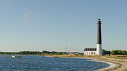
Category:Sõrve lighthouse
Jump to navigation
Jump to search
| Object location | | View all coordinates using: OpenStreetMap |
|---|
lighthouse in Estonia | |||||
| Upload media | |||||
| Instance of | |||||
|---|---|---|---|---|---|
| Location | Saaremaa Rural Municipality, Saare County, Estonia | ||||
| Located in or next to body of water | |||||
| Service entry |
| ||||
| Inception |
| ||||
| Height |
| ||||
 | |||||
Media in category "Sõrve lighthouse"
The following 37 files are in this category, out of 37 total.
-
Lighthouse - panoramio (28).jpg 2,592 × 4,608; 3.64 MB
-
Majak.jpg 1,057 × 678; 123 KB
-
S6rve tuletorn 2010 (2).jpg 1,800 × 1,350; 570 KB
-
S6rve tuletorn 2010.jpg 1,500 × 2,000; 705 KB
-
S6rve tuletorn.jpg 1,195 × 800; 420 KB
-
Saaremaa lighthouse - panoramio.jpg 2,160 × 3,840; 2.5 MB
-
Sorve tuletorn 20050807.jpg 400 × 1,002; 113 KB
-
Sorve tuletorn.JPG 532 × 800; 185 KB
-
Sorve.gif 25 × 40; 335 bytes
-
Sorve.jpg 870 × 577; 40 KB
-
Sääre (Estonie).jpg 460 × 305; 40 KB
-
Sõrve Lighthouse - panoramio (1).jpg 5,184 × 3,456; 12.25 MB
-
Sõrve Lighthouse - panoramio (2).jpg 4,998 × 3,339; 9.55 MB
-
Sõrve Lighthouse - panoramio (3).jpg 5,184 × 3,456; 10.87 MB
-
Sõrve Lighthouse - panoramio (4).jpg 5,184 × 3,456; 9.88 MB
-
Sõrve lighthouse 2009 (2).jpg 1,944 × 2,592; 1.82 MB
-
Sõrve lighthouse 2009.jpg 2,592 × 1,944; 2.13 MB
-
Sõrve lighthouse DSCF4125 01.jpg 2,448 × 3,264; 1.78 MB
-
Sõrve lighthouse DSCF4125 02.jpg 3,264 × 2,448; 1.8 MB
-
Sõrve lighthouse DSCF4125 03.jpg 3,264 × 2,448; 1.89 MB
-
Sõrve lighthouse new.jpg 5,184 × 3,456; 13.53 MB
-
Sõrve lighthouse on Saaremaa island.jpg 900 × 600; 637 KB
-
Sõrve lighthouse, 2016.jpg 3,000 × 2,000; 4.8 MB
-
Sõrve Lighthouse, Saaremaa Island, Estonia.jpg 1,583 × 1,184; 1.32 MB
-
Sõrve lighthouse, Saaremaa, 2016.jpg 3,000 × 2,000; 5.38 MB
-
Sõrve lighthouse.JPG 900 × 600; 516 KB
-
Sõrve majakas.jpg 853 × 1,280; 119 KB
-
Sõrve säär tuletorniga 2009.jpg 3,000 × 2,000; 3.43 MB
-
Sõrve Säär.jpg 3,264 × 2,176; 1.58 MB
-
Sõrve tulerotn august 2013.jpg 2,853 × 4,307; 5.78 MB
-
Sõrve tuletorn 2008.jpg 1,113 × 1,669; 400 KB
-
Sõrve tuletorn 2013.jpg 3,751 × 2,084; 3.65 MB
-
Sõrve tuletorn august 2014.jpg 1,060 × 1,600; 793 KB
-
Sõrve tuletorn ja majakahoone.jpg 1,280 × 853; 93 KB
-
Sõrve tuletorn.JPG 3,872 × 2,592; 1.66 MB
-
Torgu Parish, Saare County, Estonia - panoramio (2).jpg 4,752 × 3,168; 5.88 MB
-
Саарема.jpg 949 × 633; 180 KB


